


WASHINGTON, D.C., August 12, 2015 – A series of maps released today by the American Farm Bureau Federation show how the Environmental Protection Agency will radically expand its jurisdiction over land use if its controversial Waters of the United States rule takes effect as expected Aug. 28. That expansion comes even as major parts of the rule remain largely incomprehensible to experts and laypeople, alike.
The maps, prepared by Geosyntec Consulting, show the dramatic expansion of EPA’s regulatory reach, stretching across wide swaths of land in Pennsylvania, Virginia and Montana. In Pennsylvania, for example, 99 percent of the state’s total acreage is subject to EPA scrutiny. Landowners have no reliable way to know which of the water and land within that area will be regulated, yet they must still conform their activities to the new law.
“Farmers face enforcement action and severe penalties under EPA’s new rule for using the same safe, scientifically sound and federally approved crop protection tools they’ve used for years,” AFBF President Bob Stallman said. “This rule creates a new set of tools for harassing farmers in court, and does it all with language that is disturbingly vague and subject to abuse by future regulators. It’s worth saying again: The EPA needs to withdraw this rule and start over.”
Maps prepared to date can be found here:
Additional maps are being developed for parts of Missouri, New York, Oklahoma and Wisconsin.
The interactive maps in detail:
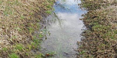
The maps’ base layer shows areas regulated as tributaries and adjacent wetlands without a case-specific “significant nexus” analysis under previous rules. Through a progression, the maps add “ephemeral streams”—low spots in the land that drain and channel water away from farmland after a rain but are otherwise dry. The EPA has sometimes asserted jurisdiction over such areas before, but only after a site-specific finding of a “significant nexus” to downstream waters. Under the new rule, all such “ephemeral tributaries” are regulated.
With this added jurisdiction in place, the Clean Water Act will prohibit many common agricultural practices in or around these ephemeral features. Any unpermitted discharge—whether pesticides, fertilizer or even disturbed soil—will leave farmers vulnerable to enforcement by EPA, the Corps, or private citizens, with severe potential penalties. This means unless farmers are able to navigate the regulatory system to secure a costly Clean Water Act permit, farming in many areas will be significantly restricted.
The maps’ next layer shows how the rule expands the definition of regulated “adjacent waters” to cover all waters (including wetlands) that lie, even partially, within 100 feet on either side of these newly regulated ephemeral drains. Next, they show where even more “adjacent waters” may lie—and this is where the vast uncertainty comes in. Where any part of a water or wetland is within the 100-year floodplain of a tributary, and not more than 1,500 feet (1/4 mile) from the tributary, that entire water feature is regulated. The uncertainty springs from the fact that many areas lack flood zone maps. What’s more, many such maps are out-of-date, and most ditches and ephemeral streams do not have mapped flood zones. The result is that farmers and other landowners lack even the basic tools to identify wetlands or other waters that are automatically regulated under the rule.
The final blow—the almost unlimited reach of the rule—is shown in the final map layer that covers waters that are not “tributaries” or “adjacent,” but may still be jurisdictional based on a “significant nexus” to downstream waters. The WOTUS rule allows “significant nexus” regulation of waters (including wetlands) that lie even partially within 4,000 feet (about ¾ mile) of any tributary. Mapping 4,000 feet from even just the known ephemeral streams—ignoring ditches and not-yet-identified ephemeral tributaries—shows that this 4,000-foot zone of uncertainty covers the entire landscape in many parts of the country.
Source: American Farm Bureau Federation
